Stawamus Chief Hike: Chains, Ladders and Real Difficulty
Is the Stawamus Chief hike accessible to an untrained hiker?
It's possible for a reasonably fit beginner in good weather, but it is a real mountain hike, not a walk: about 700 m of elevation gain over roughly 3 to 4 hours up, with steep, exposed sections protected by chains and ladders. Someone with no hiking fitness and a fear of exposure should plan on the First Peak only, in dry conditions, with sturdy shoes and plenty of time.
What the climb actually involves
The Stawamus Chief looms directly above the highway in Squamish, a single slab of granite so large it ranks among the biggest monoliths on the planet. From the parking lot at its base to any of its three summits, hikers gain roughly 700 m of elevation — climbed on foot, on a trail that is steep and rocky nearly the entire way. There is no easing into it: the path starts climbing within the first few minutes and rarely lets up until the granite opens onto a summit view over Howe Sound.
That figure, 700 m, is the number to hold onto when deciding whether this hike is realistic for you. It is not a technical climb — this guide does not cover the roped, technical routes up the Chief’s granite face itself, which belong to a different world of sport entirely and are covered separately for anyone chasing that kind of challenge. What this trail asks of a hiker is stamina, sturdy footwear, comfort with heights, and enough daylight to do the descent without rushing. None of that requires rope work or a harness. All of it requires more than a stroll.
Not a walk, not technical climbing either
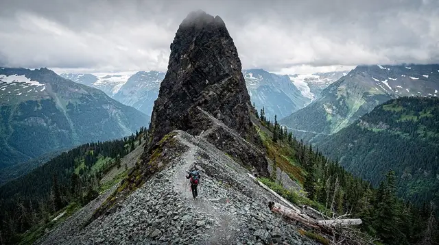
It helps to place the Stawamus Chief hike correctly between two things it is often confused with. On one side, people assume “hike” means an easy nature walk, something like the flat forest paths around Alta Lake or Lost Lake back in Whistler. It is not that. The grade is consistently steep, the surface is roots, rock and packed dirt rather than groomed gravel, and several stretches near the top cross exposed granite where a slip has real consequences.
On the other side, people sometimes lump the Chief in with rock climbing because of its reputation as a climbing destination and its position right beside Shannon Falls, a magnet for a very different, technical crowd. The hiking trail and the climbing routes share a mountain but almost nothing else. Climbers ascend the vertical granite face with ropes, harnesses and protection, often taking a full day or more on a single route. Hikers walk up a marked trail on the back and side of the mountain, using their hands on rock and holding fixed chains at a handful of steep sections, but never touching rope, harness or the sheer face itself.
Three summits, three different commitments
The Stawamus Chief has three named summits, and this is where most of the planning decisions happen.
First Peak is the closest, most direct summit and the one almost every first-time hiker should aim for. The trail to First Peak gains most of the elevation in a fairly continuous push through forest, crosses a few short chain-assisted rock steps near the top, and opens onto a wide granite dome with a sweeping view over Squamish, Howe Sound and the water below. Most hikers complete the round trip in 3 to 4 hours.
Second Peak sits further along a connecting ridge trail from First Peak and is quieter, with its own views but a longer approach.
Third Peak is the furthest and involves the most additional elevation change beyond First Peak, since the trail dips before climbing again. Combining all three summits in one outing typically takes 5 to 7 hours and represents a genuinely long mountain day, not a casual half-day walk.
For someone asking whether they, personally, can do this hike, the honest answer nearly always starts with: aim for First Peak only, and treat the other two as a decision to make once you’re already there and feeling strong.
| Summit | Round-trip time (approx.) | Extra elevation past First Peak | Suitable for a first attempt |
|---|---|---|---|
| First Peak | 3-4 hours | — | Yes |
| Second Peak | 4-5 hours | Moderate | Only if First Peak felt manageable |
| Third Peak | 5-7 hours (all three) | Most | Experienced hikers only |
The chains and ladders, honestly described
The sections with fixed chains and short ladder-like rungs exist at a handful of specific spots — steep granite steps and exposed slab crossings where the trail would otherwise be unsafe to climb hand-over-hand on bare rock. They are there to help, not to warn you off. A hiker with no climbing background uses them the same way they’d use a stair rail: grip the chain, place your feet on the rock steps or grooves cut into the granite, and move up deliberately rather than hurrying.
What makes these sections feel harder than they sound in a trail description is exposure — the sense of open air beside or below you as you climb — rather than technical difficulty. The chains themselves are solidly anchored and well maintained. The real variables are the hiker’s comfort with heights, the condition of the rock, and how crowded the section is when you arrive. Wet granite, morning dew, or an early frost make these same steps meaningfully more slippery than they are on a dry summer afternoon, which is the single biggest factor in how hard this hike actually feels on any given day.
So — is it accessible to a non-hiker?
Yes, with real caveats, and this is worth stating plainly rather than glossing over. A person who does not exercise regularly, has never worn hiking boots, or is significantly uneasy with heights will find the Stawamus Chief a genuinely tough, possibly unpleasant outing, even to First Peak alone. The 700 m of gain over a rocky, uneven trail is a serious cardiovascular effort regardless of the chains, and the exposed sections near the top will test anyone’s nerve on their first exposure to that kind of terrain.
A person who is reasonably active — someone who walks regularly, isn’t intimidated by stairs, and doesn’t have a strong fear of heights — can expect to manage First Peak without technical difficulty, in 3 to 4 hours, arriving tired but proud rather than in over their head. That is the realistic target audience for this hike as a first mountain trail in the Sea to Sky corridor.
Where it goes wrong is almost always the same handful of mistakes: starting too late in the day, wearing running shoes or sandals instead of real hiking footwear, underestimating how long the descent takes on tired legs, or attempting all three peaks on a whim without checking remaining daylight. None of those are about fitness — they’re about preparation, and every one of them is avoidable.
What to bring and when to go
- Footwear: real hiking shoes or boots with grippy soles. Smooth-soled sneakers on wet granite are the most common cause of slips.
- Water: at least 1.5 to 2 litres per person; there is no water source on the trail.
- Time buffer: start early enough to be well off the exposed sections before dusk, especially outside the long daylight of midsummer.
- Layers: the summit is windier and cooler than the parking lot, even on a warm day.
- Headlamp: cheap insurance if the hike takes longer than planned.
- Weather check: rain or a fresh dusting of snow at elevation changes the difficulty of the chain sections dramatically; postpone rather than push through wet granite.
Spring and early summer bring the trail into good condition once snow clears at elevation, typically from around May onward; September and early October offer cooler air and thinner crowds. Midsummer weekends are the busiest, with queues forming at the narrowest chain sections. A weekday start, or an early morning departure, avoids most of the bottleneck.
How it compares to nearby trails
If the numbers above sound like more than you want to take on, two alternatives nearby are worth knowing about. The Sea to Sky Gondola, directly across the highway, reaches a comparable elevation on the neighbouring mountain by cable car, with short, easy trails and a suspension bridge once you’re up — the same panoramic reward over Howe Sound without the climb. For hikers who want more distance and solitude rather than less effort, trails through Squamish Canyon and Murrin Park offer gentler terrain closer to sea level.
Hikers who complete the Chief and want more of the same style of trail, without the crowds, often look toward Watersprite Lake, a longer alpine day trip that trades the chains and exposure of the Chief for sustained distance and a turquoise lake payoff.
Doing it with a guide
A guided option removes most of the planning risk described above: pacing, timing, and knowing exactly which sections need the chains handled with care. If you’d rather not solve the logistics yourself, a guided hike up the Stawamus Chief covers the route with someone who knows exactly where the exposed steps are and how to pace a group with mixed fitness levels.
For a longer alpine day away from the crowds, the guided day trip to Watersprite Lake is a good next step once the Chief feels comfortable. And if the reward you’re after is as much about the afternoon after the summit as the summit itself, the Stawamus Chief hike paired with a local brewery tasting turns the climb into a full day out from Squamish, tired legs and all.
Getting there and pairing the visit
The trailhead sits right off Highway 99 at Squamish, roughly halfway between Vancouver and Whistler, which makes it an easy stop on a Sea to Sky road trip or a standalone day trip from either end. Many visitors pair it with Shannon Falls next door for a short waterfall walk before or after the climb, since the two share a parking area. Squamish itself has enough food, gear shops and lodging to make a full day of it rather than a rushed stop between destinations.
For planning a longer stay, see our guide to driving Highway 99 for what to expect on the road, and the two-day Whistler and Squamish itinerary for how the Chief fits alongside the rest of the corridor.
If you’d rather compare climbing options directly on the mountain, the beginner rock climbing guide for Squamish and the via ferrata experience cover the technical side this article leaves out. Anyone still deciding where to base themselves for a Sea to Sky trip should also read Squamish vs. Whistler: where to base yourself.
Browse more hiking trails in the corridor, or see everything on offer in Squamish if the Chief is only one stop on a longer visit.
Stawamus Chief hike: your questions answered
Can a beginner hike the Stawamus Chief?
Yes, with realistic expectations. A beginner in reasonable shape can reach the First Peak in 3 to 4 hours round trip. It is steep and rocky throughout, not a groomed trail, so it will feel harder than a typical park walk even without any technical difficulty.
How much elevation gain is there?
About 700 m from the trailhead parking lot to the summits, gained over roughly 2.5 to 3 km one way. That is a similar workload to climbing a 60-storey building, spread over a rooty, rocky forest trail rather than stairs.
Do you need climbing experience for the chains and ladders?
No technical climbing skill is required. The chains and short ladder sections are fixed in place to help hikers up steep granite steps and across exposed slabs; you use your hands and feet on the rock and hold the chain for balance and security, not to haul yourself up a cliff.
Is the Stawamus Chief hike dangerous?
The trail itself is well marked and heavily used, but the exposed sections near all three summits have real consequences for a slip, especially in rain, morning dew or with a heavy pack. Most incidents happen to hikers who are unprepared, arrive too late in the day, or attempt it in wet or icy conditions.
How long does the hike take?
Most hikers take 3 to 4 hours round trip for the First Peak alone, and 5 to 7 hours to visit all three summits via the connector trails. Add extra time for photos at the top, since the viewpoints over Howe Sound are a major reason people come.
Which of the three peaks should a first-timer choose?
The First Peak is the shortest, most direct summit and gives an equally spectacular view over Squamish and Howe Sound, which makes it the sensible choice for a first attempt or for anyone unsure of their fitness or comfort with exposure.
Is there a cable car or gondola up the Stawamus Chief?
No. The Stawamus Chief has no lift of any kind; every summit is reached entirely on foot. The Sea to Sky Gondola sits on a separate mountain across the highway and does not connect to the Chief’s trails.
What should you bring for the Stawamus Chief hike?
Sturdy hiking shoes or boots with real grip, at least 1.5 to 2 litres of water, layers for wind at the top, a headlamp in case you run later than planned, and enough daylight buffer to be off the exposed sections before dusk.
Hiking on GetYourGuide
Verified deep-linked GetYourGuide tours. Book through these links and we earn a small commission at no cost to you.
GetYourGuide does not provide a product photo for this activity — the image shows the meeting point, photographed by us.