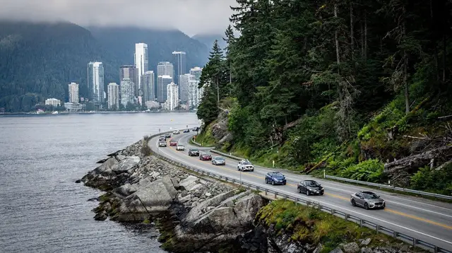
What “Sea to Sky” Actually Refers To
The Sea to Sky Highway is a road, not an attraction. It is the local name for Highway 99 between Vancouver and Whistler, so called because it climbs from sea level at Howe Sound to the alpine terrain around Whistler over the course of a couple of hours. Locals, tour operators and road signs all use the name interchangeably with “Highway 99,” and this page is about that road: the distance, the drive time, the rules that apply to it, and the decisions worth making before you get behind the wheel or book a seat.
It is easy to confuse this name with the Sea to Sky Gondola, a single cable car attraction in Squamish that opened in 2014 and carries visitors to a viewing platform and suspension bridge partway up the highway. The gondola sits beside the highway and shares its name, but it is one stop among many, not the road itself. If a listing, a tour description or a friend’s recommendation says “Sea to Sky,” check whether they mean the drive or the specific gondola ride — the two get mixed up constantly, including in hastily written itineraries.
This page deliberately does not go deep on any single stop along the corridor. Brandywine Falls, Porteau Cove, Britannia Beach and the Sea to Sky Gondola each have their own detailed pages linked below; here the focus stays on the road that connects them.
Distance and Drive Time: the Numbers That Matter
From central Vancouver to Whistler Village, Highway 99 covers about 121 km. Driven without stops, in clear conditions, that is roughly 1 hour 45 minutes. Almost nobody actually drives it in one stretch on a first visit, since the road passes several worthwhile viewpoints and towns along the way.
Starting from Vancouver International Airport (YVR) changes the numbers slightly, because the airport sits on an island south of downtown Vancouver, adding distance before you even reach the highway proper. From YVR, expect roughly 135 km and closer to 2 hours 30 minutes, once airport-area roads and typical traffic are factored in. Both figures assume no highway closures and no lengthy photo stops — build in extra time for either.
| From | Distance | Typical drive time |
|---|---|---|
| Downtown Vancouver | ~121 km | ~1 h 45 |
| Vancouver Airport (YVR) | ~135 km | ~2 h 30 |
| Horseshoe Bay ferry terminal | ~110 km | ~1 h 30 |
| Squamish (midpoint) | ~60 km | ~50 min |
If you are arriving by ferry from Vancouver Island rather than by air, the Horseshoe Bay terminal actually sits closer to Whistler than downtown Vancouver does, and joins Highway 99 north of the city, shaving a little time off the drive.
Winter Tires: a Legal Requirement, Not a Suggestion
Highway 99 between Vancouver and Whistler is one of British Columbia’s designated winter routes. From 1 October to 30 April, vehicles on this stretch must be fitted with winter tires (marked with the mountain-and-snowflake symbol, or a genuine all-season tire rated M+S) or carry chains, regardless of what the weather is doing on the day you happen to drive. This is enforced, not a courtesy suggestion, and it applies even on a dry, sunny October afternoon — the date on the calendar decides it, not the forecast.
If you are renting a car for a Whistler trip inside that window, confirm at the counter that the vehicle is equipped with winter tires rather than assuming it. Rental companies operating out of Vancouver and YVR generally comply automatically for this period, but it is worth a direct question rather than a guess, particularly for rentals booked well outside British Columbia.
Closures: Rockfall, Snow, and No Detour
The Sea to Sky Highway runs along steep terrain above Howe Sound and through canyon sections further north, and it closes for short periods several times most years — for rockfall, avalanche control work, heavy snowfall, or collisions. The most exposed stretches include the cliffs above Howe Sound near Porteau Cove and Britannia Beach, and Cheakamus Canyon further north toward Whistler.
The practical consequence is simple and worth planning around: there is no meaningful alternate route between Vancouver and Whistler. A closure means waiting for the road to reopen, not taking a detour. Before a winter drive, or after heavy rain at any time of year, check British Columbia’s official road conditions service (DriveBC) rather than relying on a map app, which will not always reflect a fresh closure. Building slack into your schedule — arriving a day early for an event, or padding a flight connection — matters more on this road than on most.
Driving Yourself, or Letting Someone Else Drive
Self-driving gives the most freedom: you choose which stops to make, how long to linger at each, and when to turn back. It also means one person in the car is watching a demanding road instead of the scenery, dealing with winter tire requirements, and navigating paid parking once you reach Whistler Village, which is itself pedestrian and keeps vehicles at its edges.
For a day trip from Vancouver without the driving, a guided highway tour or a scheduled shuttle removes all of that from the equation. A day tour along the corridor, like this guided day trip up the Sea to Sky corridor from Vancouver, typically builds in stops that a solo driver might otherwise skip out of time pressure, and someone else handles the winter tires, the parking, and the closures.
Scheduled coach shuttles between YVR or downtown Vancouver and Whistler run several times daily year-round and are the simplest no-car option for travellers who just need to get from one end to the other. Private transfers exist as a door-to-door alternative for groups or anyone with luggage and a fixed schedule.
For a genuinely different way to skip the road altogether, floatplanes connect Vancouver’s downtown harbour directly to Whistler in season — a scenic option worth considering for a special arrival, such as this day trip to Whistler by seaplane from Vancouver, which turns the transfer itself into part of the trip rather than a means to an end.
What You Pass Along the Way
Highway 99 is genuinely scenic for its whole length, and several stops along it earn a detour of their own rather than a glance from the car window. Rather than repeat that detail here, each has its own page: Brandywine Falls drops beside a short walk from the highway; the Tantalus lookout frames one of the corridor’s best mountain views; Porteau Cove sits directly on Howe Sound; and Britannia Beach holds the former copper mine turned museum.
Squamish itself, roughly the halfway point, is worth treating as a stop rather than a pass-through — it is where the Sea to Sky Gondola sits, along with granite climbing at the Stawamus Chief and water-based activities on the Squamish and Elaho rivers, from calmer paddling with a four-hour single-sit-in kayak rental to whitewater on the Elaho river rafting run known as the Wet and Wild Elaho Exhilarator.
Treating the drive as a single leg with one stop in Squamish is a reasonable plan for a first visit; treating it as a full day of stops, with an overnight in Whistler at the end, suits anyone who wants to see the corridor properly rather than glimpse it through a windscreen.
Fuel, Coverage and Practical Driving Notes
Mobile coverage along Highway 99 is inconsistent in the canyon sections and around Cheakamus, so downloading offline maps before you leave Vancouver is sensible. Fuel stations exist in Squamish and at a couple of points along the way, but they thin out compared with city driving — leaving Vancouver or Whistler with a reasonably full tank avoids relying on finding one mid-route.
Speed limits vary by section and are enforced; the road has a mix of passing lanes and long stretches without one, and impatient overtaking on the two-lane sections is a real source of the collisions that cause closures. Cyclists use sections of the highway’s shoulder in summer, and wildlife, including the black bears common around Whistler and Squamish, occasionally appears near the road edge, particularly at dawn and dusk.
Whistler-Bound Alternatives Worth Comparing
Not every visitor needs to drive the whole corridor themselves, and not every day out needs to end at the highway’s endpoint in Whistler. A rafting-and-zipline day built around Whistler itself, such as this one-day zipline or rafting adventure in Whistler, is a reasonable way to spend a full day already in the resort rather than adding driving on top of it, while visitors basing themselves in Vancouver for a single day should weigh the road trip itself against the many other ways to see the corridor covered in the guides below.
Sea to Sky Highway: Questions Before You Drive
Is the Sea to Sky Highway the same as the Sea to Sky Gondola?
No, and mixing them up is the most common confusion visitors make. The Sea to Sky Highway is Highway 99, the road between Vancouver and Whistler. The Sea to Sky Gondola is a single cable car in Squamish, about halfway along that road, that carries passengers up to a viewing deck and suspension bridge. You drive the highway to reach Squamish; the gondola is one specific attraction you can stop for on the way.
How far is Whistler from Vancouver on Highway 99?
It is about 121 km from central Vancouver, or roughly 135 km from Vancouver International Airport (YVR), since the airport sits south of downtown. Driving time is about 1 hour 45 minutes from the city with no stops, and closer to 2 hours 30 minutes from YVR once you account for the extra distance and airport-area traffic.
Are winter tires really required by law on this road?
Yes. Highway 99 falls under British Columbia’s designated winter routes, where winter tires (marked with the mountain and snowflake symbol, or all-season tires rated M+S) or chains are a legal requirement from 1 October to 30 April, regardless of the actual weather on the day you drive. Rental cars booked for this period should be confirmed as winter-tire equipped, and it is worth checking before you leave the rental counter.
Does the Sea to Sky Highway close often?
It closes for short periods several times most years, most often for rockfall, avalanche control, heavy snow or collisions, particularly through Cheakamus Canyon and other steep, exposed sections. There is no practical alternate route between Vancouver and Whistler, so a closure means waiting, not detouring. Check DriveBC before you leave, especially in winter or after heavy rain.
Can I get to Whistler without driving myself?
Yes. Scheduled coach shuttles run several times a day between YVR or downtown Vancouver and Whistler, private transfers can be booked door to door, and several operators run guided day tours that handle the driving and build in stops along the way. Floatplanes and helicopters also connect Vancouver directly to Whistler in season, skipping the highway altogether.
Is there a train to Whistler?
No regular passenger train connects Vancouver to Whistler for point-to-point travel; the historic Rocky Mountaineer service that once ran this route is a scenic tourist product, not a practical transport option, and it does not run year-round. For everyday transport, the choice is between driving, coach shuttle, private transfer, or air.
Should I rent a car or take a tour for a day trip from Vancouver?
A rental car gives the most flexibility to stop where you like, but it also means paying attention to a demanding road, watching the clock on the return drive, and dealing with winter tire rules and parking in Whistler Village. A guided day tour or shuttle removes all of that: someone else drives, stops are pre-planned, and you can look at the scenery instead of the road.