Joffre Lakes Hike: Permit and Closures Explained
Do you need a permit to hike Joffre Lakes, and is the trail currently open?
Yes — BC Parks requires a free day-use pass for Joffre Lakes Provincial Park in high season, booked online in advance, and the trail has been closed for several periods since 2023 under an agreement with the Lil'wat and N'Quatqua Nations. Always check the official BC Parks page the morning you plan to go, since a pass does not guarantee the park is open.
Three Turquoise Lakes, One Very Popular Trail
Joffre Lakes is the photograph everyone has seen before they ever set foot in British Columbia: three glacier-fed lakes, each a slightly different shade of turquoise, stacked up a single valley below a hanging glacier. It is also, almost every summer weekend, one of the most crowded trails in the province — and, since 2023, a trail that has been closed for entire stretches of the season with little warning. Before you plan a day around it, you need two separate answers: what the hike actually involves, and whether you can legally be on it the day you show up.
This guide covers the trail itself — distance, elevation, what each lake looks like, the permit system, and the closures — and nothing else. It does not cover Garibaldi Lake or Panorama Ridge, which sit in a different part of Garibaldi Provincial Park and have their own dedicated guides, and it does not walk through the driving route from Pemberton, which belongs on a getting-there page rather than a trail guide.
The Numbers: Distance, Elevation, Three Lakes
The full hike from the trailhead to the Upper Lake and back is commonly quoted at around 10 km round trip, with about 400 m of elevation gain spread unevenly across three distinct sections:
| Section | Distance from trailhead | What you see |
|---|---|---|
| Lower Lake | ~1 km | The smallest and least dramatic of the three, often skipped by hikers pressed for time |
| Middle Lake | ~3 km | The most photographed lake, with the clearest turquoise water and a view of the glacier |
| Upper Lake | ~5 km | The largest and most alpine of the three, with a walk-in campground nearby |
Most hikers walk to the Middle Lake and back for a shorter day of roughly 6 km, or continue to the Upper Lake for the full 10 km. The trail to the Middle Lake is a steady, well-built climb on stairs and packed dirt that a reasonably fit beginner can manage. The stretch from the Middle Lake to the Upper Lake is narrower, rockier, and noticeably steeper, and it is where most of the day’s elevation gain is concentrated — plan on it taking longer than the distance alone suggests.
Because the entire route sits within Garibaldi Provincial Park’s Joffre Lakes section, it shares the same permit system and the same wildlife as the rest of the park, without overlapping the separate trail networks that lead to Garibaldi Lake or Panorama Ridge further south — those are described on their own pages, not here.
Do You Need a Permit? Yes, in High Season
BC Parks manages Joffre Lakes with a free timed day-use pass during the busiest months, typically summer through early autumn. The pass is not a fee — it is a capacity limit, capped at a fixed number of vehicles and hikers per day, released online a set number of days in advance and claimed on a first-come basis. Passes for popular weekend dates are frequently gone within minutes of release.
A few practical points that catch first-time visitors out:
- The pass covers the park, not just the upper trail — it applies even if your plan is to walk only as far as the Lower Lake.
- One pass typically covers one vehicle and its occupants, so carpooling groups need to book together rather than individually.
- Arriving without a valid pass during a controlled period can mean being turned away at the trailhead after the drive up Duffey Lake Road, which is the single most expensive mistake associated with this hike.
- The pass system does not by itself guarantee the park is open — see the closures below.
Outside the controlled season, no day-use pass is required, but the trail, parking, and closure conditions can still change without notice, so the advice below applies year-round, not only in summer.
The Closures: Why the Trail Has Shut Down Since 2023
This is the part of planning a Joffre Lakes trip that most visitors miss entirely. Since 2023, Joffre Lakes Provincial Park has been closed for multiple full seasons and shorter periods under an agreement between BC Parks and the Lil’wat and N’Quatqua Nations, on whose territory the park sits. These closures have not followed a fixed annual calendar — they have opened and closed the park at different points across different years, sometimes with only a short public notice window before the gate goes up.
Practically, this means that anything you read here, or on a booking platform, or on a blog post from a previous year, can be out of date by the time you drive up. There is no way to build a permanently accurate closure calendar into a travel guide, because the closures are not on a permanent schedule. What is reliable is the process:
- Check the official BC Parks page for Joffre Lakes Provincial Park before you leave home.
- Check it again the morning of your visit — conditions and access have occasionally changed within the same week.
- Have a backup plan. If Joffre Lakes is closed, the Garibaldi Lake and Cheakamus Lake trails sit in the same broader park system and are managed separately.
If you take away one thing from this page, make it this: never build a Whistler or Sea to Sky itinerary around Joffre Lakes as a guaranteed stop. Treat it as a bonus you confirm at the last minute, not a fixed pin on the map.
Planning the Hike Itself
Difficulty. Rated moderate overall. The trail to the Middle Lake is a well-maintained, gradually ascending path suitable for most fitness levels; the push to the Upper Lake adds loose rock, roots, and a steeper grade that slows almost everyone down. Trekking poles help on the descent, which is harder on the knees than most hikers expect from the distance alone.
Timing. Most hikers doing the full Upper Lake round trip should budget four to six hours, excluding stops for photos, which at the Middle Lake can easily add another twenty minutes on a clear day. Starting early — ideally before sunrise in midsummer — matters for two separate reasons: the light on the water is best in the first hours of the day, and the parking lot fills completely soon after.
Water color. The turquoise comes from glacial flour, fine rock sediment suspended in the meltwater from the glacier above the Upper Lake. It is usually most vivid from July through September, after the winter snowpack on the lower trail has melted out but before autumn rains add sediment run-off; a visit too early in the season can mean snow still covering parts of the upper trail, and a visit too late can mean a duller, greener tone to the water.
What to bring. Sturdy footwear rather than sandals, layers even in summer since the upper section sits at higher elevation than the trailhead, more water than you think you need, and a printed or downloaded copy of your day-use pass confirmation in case cell signal drops near the trailhead.
Getting to the Trailhead
The Joffre Lakes trailhead sits along Duffey Lake Road, north of Whistler and past Pemberton and Mount Currie, inside Joffre Lakes Provincial Park itself. This page focuses on the trail and its permit, not on the driving route or the exact distance from Pemberton — that detail belongs on a getting-there guide rather than here. What matters for planning purposes is that the parking lot is small, fills fast in season, and roadside parking is enforced, so a guided option that handles the drive and the pass logistics for you is worth weighing against a self-drive day.
Self-Drive or Guided: Two Ways to Do It
Hiking Joffre Lakes independently means securing your own day-use pass, driving yourself, and managing your own timing around the closure risk described above. A guided hike removes most of that friction: the operator handles current access conditions, transport from the Whistler or Squamish area, and pacing on the trail, which matters given how variable the closure situation has been since 2023.
For a guided full-day option that includes transport and a guide who tracks current park access before the trip departs, see the Lillooet Joffre Lakes guided hike. A more compact version built specifically around the round trip to the lakes is the Joffre Lakes hiking day trip, and travellers who want a smaller-group alternative on the same route can compare it against the small-group Joffre Lakes day trip before booking either one.
| Option | Handles the drive | Handles the day-use pass | Best for |
|---|---|---|---|
| Self-drive | No | You book it yourself | Flexible schedules, experienced hikers |
| Guided day trip | Yes | Operator manages current access | First-time visitors, no rental car |
| Small-group guided | Yes | Operator manages current access | Travellers who prefer a quieter group |
Comparing Joffre Lakes to Other Alpine Hikes
Joffre Lakes is far from the only alpine hike near Whistler, and given how often it closes, it is worth knowing the alternatives before you commit a full day of your trip to it. Our Garibaldi Lake hike guide and Panorama Ridge guide cover two longer, more demanding days in the same broader park system, while the Black Tusk guide covers the scramble to the volcanic plug above Garibaldi Lake.
If you are trying to decide between destinations rather than trails, our Joffre Lakes versus Garibaldi Lake comparison lays out the trade-offs directly. For the mechanics of the pass itself, see how to get a Joffre Lakes day-use pass, and for travellers coming up without their own car, the Joffre Lakes day trip from Vancouver guide covers transport options end to end.
If Joffre Lakes turns out to be closed on your travel dates, an alpine hiking week in Whistler itinerary builds in enough alternative trails from the hiking trails category that one closure will not derail the trip. It is also worth reading our longer piece on BC Parks passes and closures for the background on why the Lil’wat and N’Quatqua Nations agreement exists in the first place, and checking best time to visit and our best time to visit Whistler guide when you are laying out the rest of your trip around this one uncertain day.
Whistler Hikes and the Trans-Boundary Reality
The Coast Mountains around Whistler do not respect neat trail boundaries, and Joffre Lakes is part of a broader pattern of shared, Indigenous-stewarded land across the Sea to Sky corridor. The Squamish and Lil’wat Nations’ relationship to the land is also visible closer to Whistler itself, and the Squamish Lil’wat Cultural Centre in the Upper Village is a far better place to understand that context than a busy trailhead parking lot ever will be. Visiting it before or after a Joffre Lakes trip adds useful context to what the closures are actually about.
Frequently Asked Questions About Hiking Joffre Lakes
Do I need a permit to hike Joffre Lakes?
During the busy season, yes. BC Parks requires a free timed day-use pass for anyone entering Joffre Lakes Provincial Park, released online in advance and capped at a fixed number of visitors per day.
Has Joffre Lakes been closed recently?
Yes. Since 2023 the park has closed for several full seasons and shorter stretches under an agreement between BC Parks and the Lil’wat and N’Quatqua Nations, sometimes with little public notice.
How long is the Joffre Lakes hike?
The full out-and-back to the Upper Lake is about 10 km round trip with roughly 400 m of elevation gain, typically taking four to six hours for most hikers.
Can I just hike to the first lake and skip the pass?
No. The day-use pass system, when active, covers entry to the park itself, not just the upper trail, so it applies even if you only plan to walk as far as the Lower Lake.
Is Joffre Lakes hard for beginners?
The trail to the Middle Lake is a moderate, well-graded climb suitable for reasonably fit beginners, but the final push to the Upper Lake is steeper and rockier and should not be underestimated.
What is the best time of year to see the turquoise color?
The glacial flour that gives the lakes their color is usually strongest from July through September, once the winter snowpack has fully melted off the lower trail.
Is there a fee to park at the Joffre Lakes trailhead?
There is no separate parking fee, but the lot is small and fills within minutes of sunrise in summer; overflow parking along the highway shoulder is restricted and ticketed.
Can I camp overnight at Joffre Lakes?
Yes, in season, at the designated walk-in campground near the Upper Lake, but sites require a separate paid backcountry camping reservation through BC Parks and are not covered by the day-use pass alone.
Hiking on GetYourGuide
Verified deep-linked GetYourGuide tours. Book through these links and we earn a small commission at no cost to you.
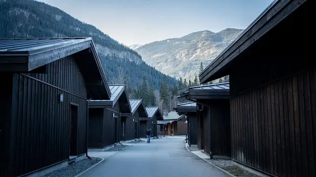
GetYourGuide does not provide a product photo for this activity — the image shows the meeting point, photographed by us.