A Short Stop Between Two Bigger Ones
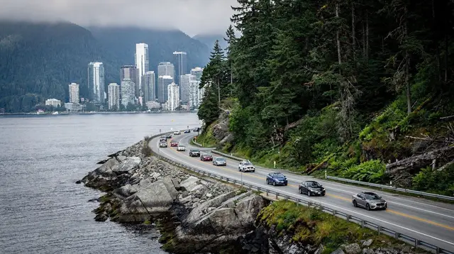
Drive the Sea to Sky Highway between Vancouver and Whistler and you will pass a string of pullouts, viewpoints and short trails built around the corridor’s geography — Porteau Cove on the shore of Howe Sound, the Tantalus lookout, Cheakamus Canyon, Shannon Falls at Squamish, and Brandywine Falls a little further north. Of all of them, Brandywine Falls is one of the easiest to underestimate and one of the easiest to actually stop for, because the whole visit — parking, walking in, looking at the falls, walking back — fits inside about half an hour.
That is the honest frame for this page. Brandywine Falls Provincial Park is not a day out the way Garibaldi Provincial Park or Joffre Lakes are. It is a waypoint: the kind of place that belongs on a road trip itinerary between Vancouver and Whistler, or on a loop that also takes in Squamish and the Sea to Sky Gondola, rather than a destination that justifies its own dedicated day. Treat it that way and it delivers exactly what it promises — a genuinely good waterfall view for very little time or effort.
Where Brandywine Falls Sits on Highway 99
Brandywine Falls Provincial Park straddles Highway 99 close to the community of Function Junction, on the approach to Whistler from the south. In practical terms, it sits between Squamish and Whistler village, closer to the Whistler end of that stretch — about 20 to 25 minutes’ drive south of the village at normal highway speeds, and a similar amount of time north of central Squamish. Coming from Vancouver or Vancouver International Airport (YVR), it is one of the last stops before Whistler itself, usually reached after Squamish, Shannon Falls and the Sea to Sky Gondola if you are taking your time on the way up.
The park is small and centred entirely on the falls and the short network of paths leading to them. There is no village, no cluster of shops, and no overnight lodging inside the park boundary — it exists purely as a highway-adjacent natural feature, protected and maintained, with parking and a picnic area as its only real infrastructure.
Getting There and Parking
Almost everyone arrives by car, whether in a rental, a private transfer, or as part of a guided tour of the corridor. The turnoff is signed directly from Highway 99, and the parking lot sits just off the highway itself, which is part of the appeal — you do not need to leave the direct road between Vancouver and Whistler to reach it.
There is no scheduled public transit stop here and, as on the rest of the Sea to Sky Highway, no train service at all between Vancouver and Whistler; if you are relying on the WAVE bus network or an airport transfer rather than your own vehicle, Brandywine Falls is one of the stops you will need a car, a tour, or a taxi to reach, since scheduled shuttles run point to point rather than pausing at roadside parks.
Winter driving rules on Highway 99 apply here as everywhere else on the corridor: winter tires or chains are legally required from October through April, and the highway itself can close for hours after heavy snow, rockfall or a crash, with no realistic detour. Check conditions before you leave if you are travelling between November and April. Parking at the falls is a marked day-use lot; some day-use areas along this stretch of highway charge a small parking fee or run a self-pay donation station, so it is worth carrying a bit of cash or a card even for a short stop.
The Walk to the Viewing Platform
From the parking lot, a wide, mostly flat path leads through second-growth forest to the main viewpoint — a fenced platform positioned to look straight across the gorge at the falls. The walk in takes most visitors somewhere between five and ten minutes at an easy pace, similar in spirit to the short approach at Shannon Falls further south, though the two trails and the two waterfalls are entirely separate features with nothing else in common. The surface is compacted gravel and boardwalk for most of the route, manageable for strollers and for most mobility levels, though the final approach to the railed platform has a few uneven or sloped sections worth taking slowly.
There is a second, rougher trail that continues past the main viewpoint and drops closer to the canyon and the base of the falls; it is steeper, less maintained, and not something to attempt in poor footwear or wet conditions. For the vast majority of visitors, the main platform is the destination, and it is enough — a clear, unobstructed view straight into the gorge with the water dropping past columnar basalt on both sides.
How Tall Is Brandywine Falls, Really?
Here is the one thing this guide will not do: hand you a confident number for the height of Brandywine Falls. Figures circulating online for this waterfall are inconsistent from source to source, and rather than repeat a number we cannot stand behind, we are flagging it plainly — check the interpretive panel at the viewpoint itself, or the official BC Parks page for Brandywine Falls Provincial Park, for the figure BC Parks currently publishes, and treat anything else as unverified.
This is worth contrasting with Shannon Falls at Squamish, whose height of roughly 335 metres is well documented and one of the tallest in British Columbia — a genuinely different order of scale, and a different visit entirely, with its own short walk from its own parking lot.
The same goes for Alexander Falls in the Callaghan Valley and Nairn Falls near Pemberton: each of those has its own figures, its own access, and its own page on this site, and none of those numbers belong to Brandywine Falls. If you are comparing waterfalls along the corridor for a road trip itinerary, look each one up individually rather than assuming they share a scale — this is exactly the kind of detail worth double-checking, since the corridor holds several waterfalls that get confused with one another in casual write-ups.
What is not in doubt is the drop itself: a single, forceful plunge over a basalt lip into a narrow, tree-lined gorge, visible in full from the main platform without obstruction — genuinely photogenic regardless of the exact number attached to it.
Best Time to Visit
Flow is strongest through spring and early summer, roughly May into July, when snowmelt from the surrounding mountains is at its peak and the falls are at their most dramatic. By late summer, flow eases off but the falls still run reliably through the warmer months, generally into October. This overlaps with the wider pattern along the corridor: best time to visit Whistler guidance for summer applies here too, since the road, the parking, and the paths are all easiest to enjoy between roughly May and October.
Winter is a different visit rather than a bad one. The park stays open, but the approach path can ice over, the platform gets cold and exposed, and parts of the falls partially freeze, which some visitors find more striking than the summer view. Footwear with real grip matters at this time of year, and the visit will typically be shorter simply because of the conditions rather than any restriction on access.
Making Brandywine Falls Part of a Bigger Day
The honest advice for most travellers is not to build a day around Brandywine Falls, but to fold it into a day that is already happening. Heading south from Whistler toward Squamish and Vancouver, it slots naturally alongside Shannon Falls, the Sea to Sky Gondola, and Britannia Mine Museum — a corridor of short, roadside stops that together add up to a full and varied day without any of them individually taking more than an hour.
Whistler: Sea to Sky Gondola Shannon and Brandywine Falls packages exactly this combination into a single guided outing from Whistler, useful if you would rather not plan the stops and timings yourself or if you are travelling without a car.
If your interest runs more toward hiking than roadside viewpoints, the falls also work as a warm-up or a cooldown on days built around Garibaldi Provincial Park, since the highway access points for both sit reasonably close together on the same stretch of Highway 99. A guided Garibaldi Lake Hiking Day Trip or the longer Whistler: Cheakamus Lake Guided Hike in Garibaldi Park both start from trailheads a short additional drive from the falls, so a quick stop here on the way past costs almost nothing in extra time.
Travelling the other direction, toward Squamish, the falls pair naturally with a climb up the Stawamus Chief — a considerably more demanding outing best attempted separately rather than added onto the same afternoon, but easy to book as a Squamish: Stawamus Chief Guided Hike for anyone building a Squamish-focused day around the falls.
Other Stops Nearby on the Corridor
Beyond the pairings above, Brandywine Falls sits within easy reach of most of the Sea to Sky Highway’s other short stops. Heading south: the Sea to Sky Gondola and its suspension bridge above Squamish, Shannon Falls a few minutes further on, and Porteau Cove and Britannia Beach closer to Vancouver.
Heading north, Whistler Village itself is the obvious next stop, with Alta Lake and Lost Lake a short distance beyond it. Anyone weighing up whether to base themselves in Squamish or Whistler for a Sea to Sky-focused trip will pass Brandywine Falls regardless of which way they choose, which is part of why it works so well as a flexible stop rather than a fixed destination.
For a longer, multi-day version of this same corridor, the three-day Sea to Sky Highway road trip itinerary lays out a full route that folds Brandywine Falls in alongside the corridor’s other short stops, with suggested overnight bases in both Squamish and Whistler.
Practical Tips
Wear proper closed shoes rather than sandals — the boardwalk sections can be slick when wet, and the rougher lower trail is genuinely uneven. Do not climb over the platform railings for a better photo; the drop into the gorge is real and the fencing exists because people have been seriously hurt here. There is no food or drink service inside the park, so bring water if you are combining this stop with a longer day on the highway, and pack out anything you bring in.
As throughout the Whistler region, black bears are present in the surrounding forest, most often seen between May and October; keep any food secured in your vehicle and give wildlife a wide, unbothered berth rather than approaching for a photo. Tap water throughout the region is safe to drink, so a refillable bottle covers most needs without buying anything on site.
Cell coverage along this stretch of Highway 99 can be patchy, so download offline maps or directions before you leave Squamish or Whistler if you are relying on a phone to navigate. Finally, resist the urge to linger for hours planning around this one stop — the falls reward a focused twenty to thirty minutes far more than an over-scheduled visit, and that time is better spent on the longer stops elsewhere on the corridor.
Brandywine Falls FAQ
How tall is Brandywine Falls?
We don’t publish a figure for Brandywine Falls here, because the height cited online varies from source to source and we couldn’t confirm a single reliable number. Check the interpretive signage at the viewpoint or the official BC Parks page before quoting a figure yourself. This is different from Shannon Falls near Squamish, whose height of around 335 metres is well documented.
How long does it take to see Brandywine Falls?
Most visitors are back at their car within 30 to 45 minutes, including the walk in, a few minutes at the viewing platform, and the walk back. It is a stop along the Sea to Sky Highway, not a destination that needs a half day or more.
Is the walk to Brandywine Falls suitable for children and strollers?
The main path from the parking lot to the main viewpoint is wide, mostly flat, and manageable for young children and standard strollers, though the final approach to the railed platform has some uneven sections. It is not a technical trail.
Is there an entrance fee for Brandywine Falls?
Brandywine Falls Provincial Park itself is free to enter. Some day-use parking areas along Highway 99 charge a small fee or ask for a suggested donation at self-pay stations, so bring a bit of cash or a card just in case.
Can you swim at Brandywine Falls?
No. There is no safe swimming area at the falls, the currents above and below the drop are dangerous, and the viewpoints are fenced for good reason. Treat this as a photo and viewpoint stop only.
Where is Brandywine Falls compared to Whistler and Squamish?
Brandywine Falls sits on Highway 99 roughly between Squamish and Whistler village, closer to the Whistler side, around 20 to 25 minutes’ drive south of the village and a shorter hop north of Squamish.
Can I combine Brandywine Falls with other stops in one day?
Yes — it pairs naturally with Shannon Falls, the Sea to Sky Gondola in Squamish, and Britannia Mine Museum on the way south, or with Whistler Village and the lakes if you are heading north. Several tours from Whistler bundle Brandywine Falls with the Sea to Sky Gondola and Shannon Falls in a single outing.
Is Brandywine Falls open in winter?
The park stays open year-round, but the path and platform can ice over and the falls partly freeze, so footwear with grip matters and the visit is shorter and more exposed to weather than in summer.